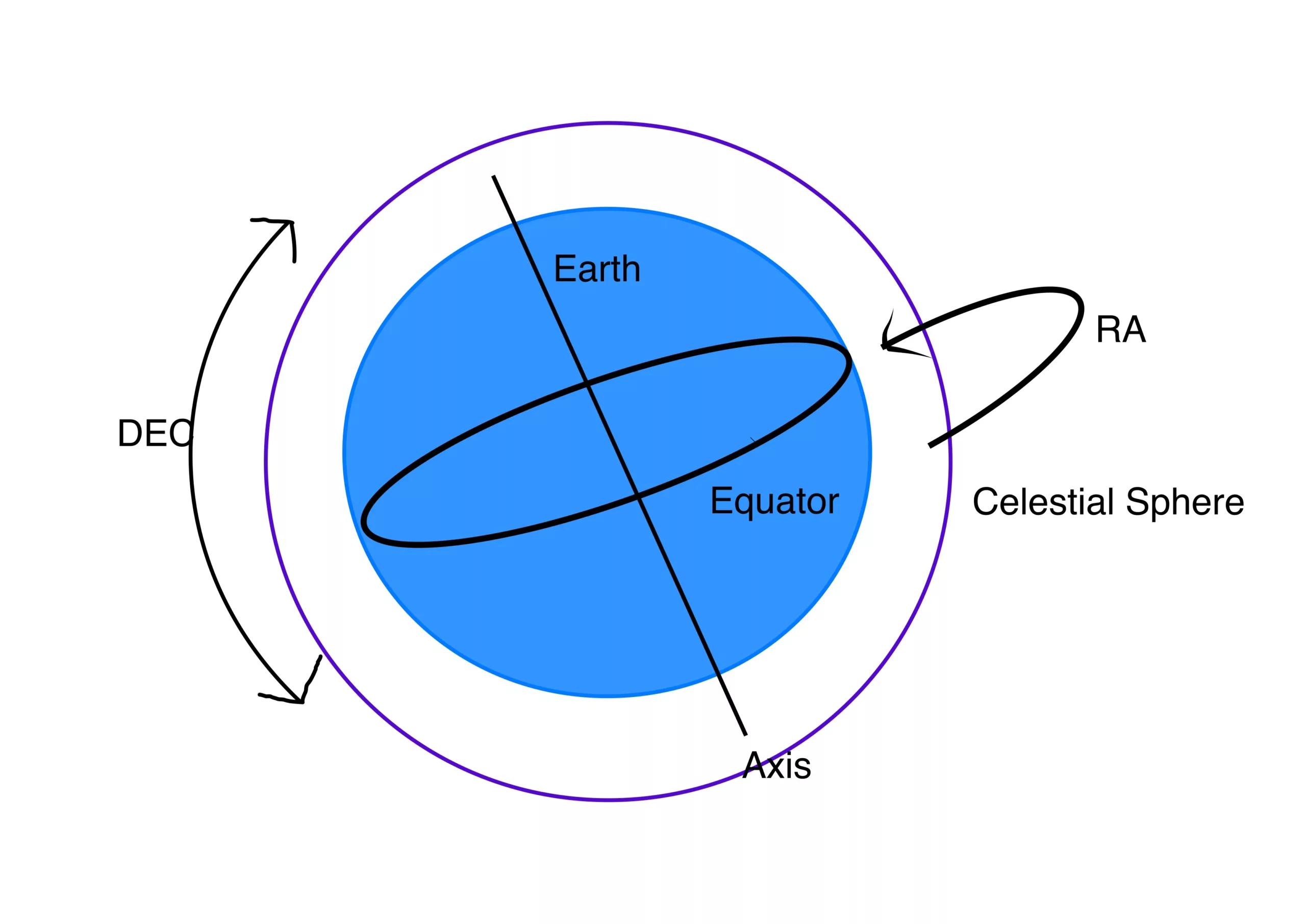
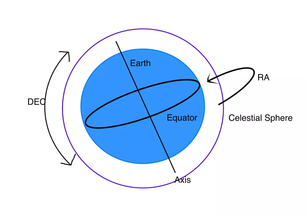
How do we find objects in the sky? Right Ascension (RA) and Declination (Dec) are two important celestial coordinates used to do this.
What is Right Ascension?
Right Ascension (RA) is similar to longitude on the Earth’s surface, except that it is measured in hours, minutes, and seconds rather than degrees of angle. RA is measured eastward along the celestial equator from the vernal equinox, which is the point where the Sun crosses the celestial equator from south to north in March. It marks the beginning of spring in the Northern hemisphere and the beginning of autumn in the Southern Hemisphere. The vernal equinox is one of the two equinoxes that occur each year when the tilt of the Earth’s axis is neither toward nor away from the Sun, resulting in equal amounts of daylight and darkness all over the Earth. It is often used as a reference point in the celestial coordinate system and is assigned a RA of 0 hours. It is also called the zero point of Ares. This is similar to the longitude reference of 0 degrees at the Greenwich Meridian. Longitude is measured in degrees of angle east or west from the Greenwich Meridian, and they meet at 180 degrees on the opposite side of earth. But unlike longitude, RA is measured in hours, minutes and seconds. Because the earth rotates once every 24 hours, there are also 24 hours in a complete circle of right ascension. And since there are 360 degrees in a circle, every one hour of right ascension is 360 divided by 24, or 15 degrees of angle.
What is Declination?
Declination is similar to latitude on the Earth’s surface, except that it is measured in degrees north or south of the celestial equator rather than degrees north or south of the Earth’s equator. The celestial equator is the projection of the Earth’s equator onto the celestial sphere and is an imaginary line that circles the sky directly above the Earth’s equator. Objects with a Declination of 0 degrees are located on the celestial equator, while objects with a positive Declination are located north of the celestial equator, and objects with a negative Declination are located south of the celestial equator.
How Do They Work Together?
Together, Right Ascension and Declination provide a way to locate objects in the sky using a coordinate system that is fixed relative to the stars. For example, the coordinates of the star Vega are approximately RA 18h 36m 56s, Dec +38° 47′ 01″. By knowing these coordinates, astronomers can use telescopes to point directly at Vega, no matter where they are located on earth.
Locating celestial objects is a little more complicated though. Because the earth’s axis wobbles like a top, the position of the earth relative to the celestial sphere also wobbles in a period of approximately 26,000 years. It follows that the celestial coordinates also change very slowly with this wobble. Therefore, the celestial coordinates also change very slightly over time, and need to be updated periodically. In the past, updates would occur to databases, also called epochs, designated by “J”, every 50 years. J1950 became J2000, which is generally close enough for the current year, But now this adjustment can be done in real time.
There are many software programs and apps that can help locate objects in the sky. Many computerized telescope mounts can do the same. Some have built-in GPS and can locate objects based on the time of day and the location of the mount without any input from the user. Many of those mounts that don’t have GPS can be controlled by planetarium software and apps. With the technology of today, it is possible to locate any celestial object at any time from anywhere on earth.
I still am confused on being able to tell people what I am seeing and how to tell them where in the sky it is. I don’t live on the equator. I have to know my own GPS at the time I see something I want to direct others to see as well and don’t understand how that figures into correlating ascension and declination from where I AM. Suggest a video demonstration I can see to observe how these things are done……..thank you in advance.
Hi Kenneth.
Knowing the coordinates alone does not really help you much to find the object in the sky. You need a sky atlas (I recommend Stellarium) or a telescope with go-to features. In both cases, your position on the planet is important. Although the object’s position in the sky is fixed in the short term (earth’s wobble changes things over long periods due to the wobble of the axis), where to find it in the sky depends on your location, the time of day, and the date. Rise and set times for these objects change every day. So something that is high in the sky tonight will be a daytime object 6 months from now and probably not visible.